
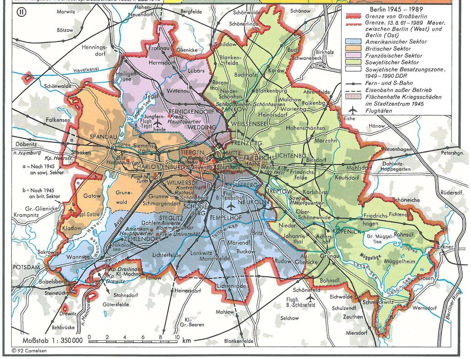
Berlin during Cold War, 1945-1989
author: CasualStockbroker/reddit, added on: 2025-07-18
CasualStockbroker:
Source: Putzger Historischer Weltatlas, Cornelsen Verlag, Berlin 1997
English translation of the legend:
thin black line - Boundary of Greater Berlin
thick red line - Berlin Wall / border between West Berlin and East Berlin (13 Aug 1961–1989)
blue - American Sector
orange - British Sector
pink - French Sector
green - Soviet Sector
white - Soviet Occupation Zone (1949-1990 German Democratic Republic)
solid black line - Mainline & S-Bahn railways
black dashed line - Railway out of service
red hatching - Extensive war damage in city center 1945
airplane symbol - Airports
Collection: cold-war - Tags: berlin, cold-war - Source: reddit.com