
Europe in 1867
Xergxilla:
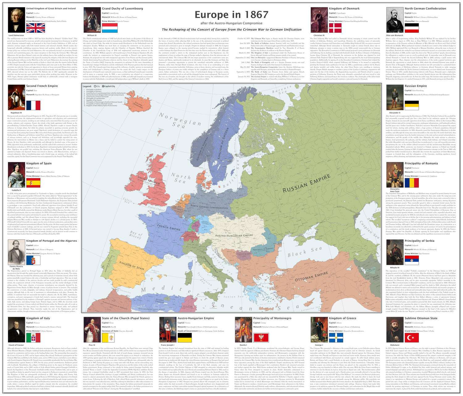
Hello everyone! After about a year since I uploaded my last one, I’m happy to present a new installment of my History of Europe series. The focus of this map is from 1853 to 1871, centered on the aftermath of the Revolutions of 1848, the Crimean War, and the wars of Italian and German unification. Due to the large file size, viewing on desktop is recommended.
I’ve also taken the time to update the project with added detail, remastered assets made with vector software, and a higher resolution basemap, which can be found here. Despite its detail, working with this base actually gave me a lot of trouble due to its age. Some of the borders, coastlines, and rivers are weird in certain areas, and a couple cities are misplaced. While I did my best to fix these when I did notice them, I’m sure there’s at least a few I didn’t get. The reference also used weird increments of latitude and an older standard of longitude, so I had to eyeball some of these lines myself. Please let me know if you find something egregiously amiss.
If you’d like to check out any of my other maps, you can find them here. I plan on remastering some of my older maps to match the new style. Hope you enjoy!
Collection: european-history - Tags: europe, 1867, 19th-century - Source: reddit.com