
Europe in 900 AD
maven.mapping:
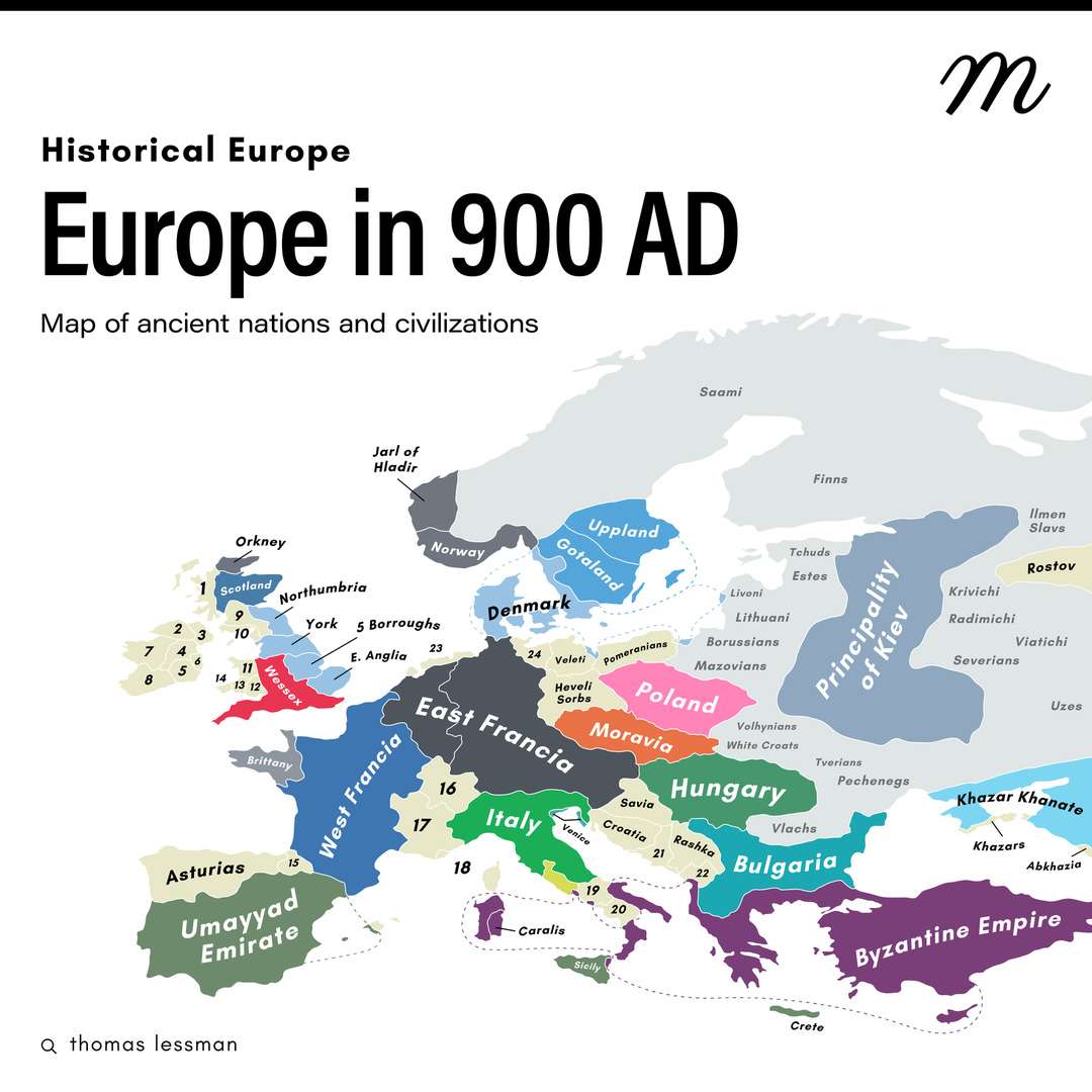
The map shows Europe in 900, showing a mosaic of states and tribes in the making. Western Europe is dominated by West Francia and East Francia, while the British Isles are home to independent kingdoms such as Scotland, Northumbria, and York. In Central Europe, Great Moravia and tribes such as the Polans and Haveli are building early state structures. Bulgaria is strong in the south, while Italy remains an independent entity. The east is dominated by the Principality of Kiev and Slavic tribes, while the Iberian Peninsula is contested by Christian Asturias and the Umayyad Caliphate. The north is controlled by the Scandinavian kingdoms, and southeastern Europe by the Byzantine Empire.
List of numbered countries 1 - Hebrides 2 - Ailech 3 - Ulaidh 4 - Meath 5 - Leinster 6 - Dublin 7 - Connaught 8 - Munster 9 - Strathciyde 10 - Norse 11 - Gwynedd 12 - Gwent 13 - Seisyllwg 14 - Dyfed 15 - Pamplona 16 - Upper Burgundy 17 - Lower Burgundy 18 - Pirate States 19 - Benevento 20 - Salerno 21 - Pagania 22 - Dioclea 23 - Frisians 24 - Abodrites
Collection: european-history - Tags: europe, 10th-century - Source: instagram.com