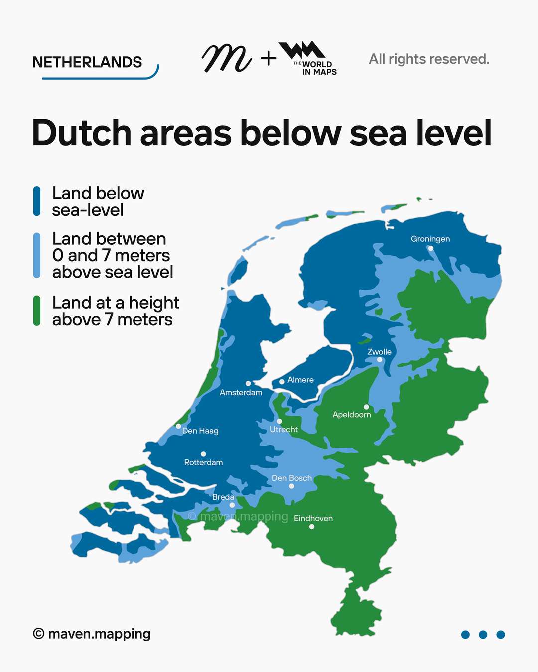
Dutch areas below sea level
author: maven.mapping/instagram, added on: 2025-12-01
maven.mapping:
This map illustrates the Netherlands’ long-standing relationship with land reclamation and water management. Much of the country’s territory, especiallyin the northwestern regions, was gradually reclaimed from the sea through centuries of engineering efforts — a process that began in the Middle Ages and continues today. The darker blue areas mark land lying below sea level, sustained by one of the world’s most advanced systems of dikes, pumps, and canals. These reclaimed lands enabled the Netherlands to expand its agricultural capacity, urbanize rapidly, and strengthen its economic position in Europe. It's a clear representation of how Dutch innovation transformed geography into a foundation for national development, resilience, and stability.
Collection: land-reclamation - Tags: netherlands, land-reclamation - Source: instagram.com