Hellerick boreal triaxial projection
author: Hellerick/reddit, added on: 2025-06-02
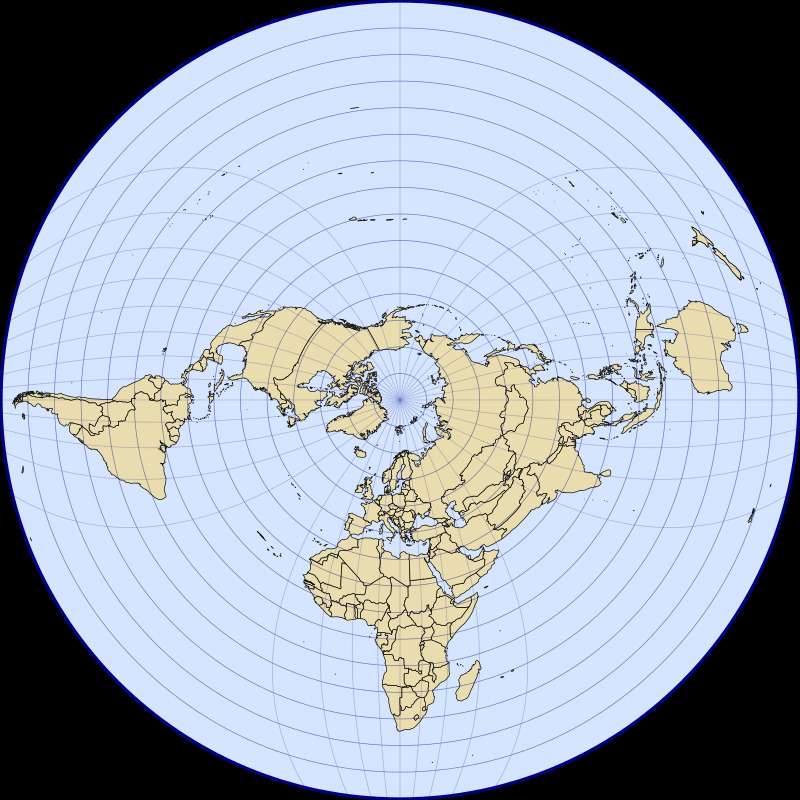
Hellerick:
A map projection invented by your humble servant. It’s similar to the one we see at the UN emblem but with one modification: there were chosen three main meridians perpendicular to each other (W70°, E20°, E110°), and the farther all the other merdians go from the north pole, the stronger they drawn to these main meridians.
Overall, it looks similar to Buckminster Fuller’s dymaxion projection, but is continuous. Unfortunately it can’t show Antarctica, and it stretches Pakistan and Afghanistan beyond reasonable. Other than that, I think it looks pretty cool.
Collection: projections - Tags: projections - Source: reddit.com