
England's invisible viking border
author: the_uk_blend/instagram, added on: 2026-03-28
the_uk_blend:
Did you know there is a 1,100-year-old border hidden in plain sight on the map of England? 🇬🇧
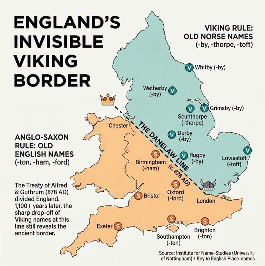
If you analyze the linguistic data of British place names, a sharp dividing line emerges that dates back to the 9th Century. This line, following the ancient Roman road of Watling Street (London to Chester), tells the story of the "Danelaw"—the area of England once ruled by Vikings.
In 878 AD, the Treaty of Alfred and Guthrum effectively split the country in two. To the South and West, the Anglo-Saxons maintained control. To the North and East, the Vikings held sway.
Today, you can still see this political split just by reading road signs.
According to data from the Institute for Name-Studies, the former Viking territory is densely packed with names ending in "-by" (Old Norse for village) and "-thorpe" (outlying farm). Places like Grimsby, Derby, Whitby, and Scunthorpe are linguistic fossils of Viking rule.
Cross that invisible line to the South, and those names virtually disappear, replaced by the Anglo-Saxon suffixes "-ton" (enclosure/estate) and "-ham" (homestead), such as Brighton, Southampton, and Birmingham.
Politics change, but geography and language tend to stick. We are still living on either side of the Viking line.
Collection: shadow-borders - Tags: england, shadow-borders, placenames - Source: instagram.com