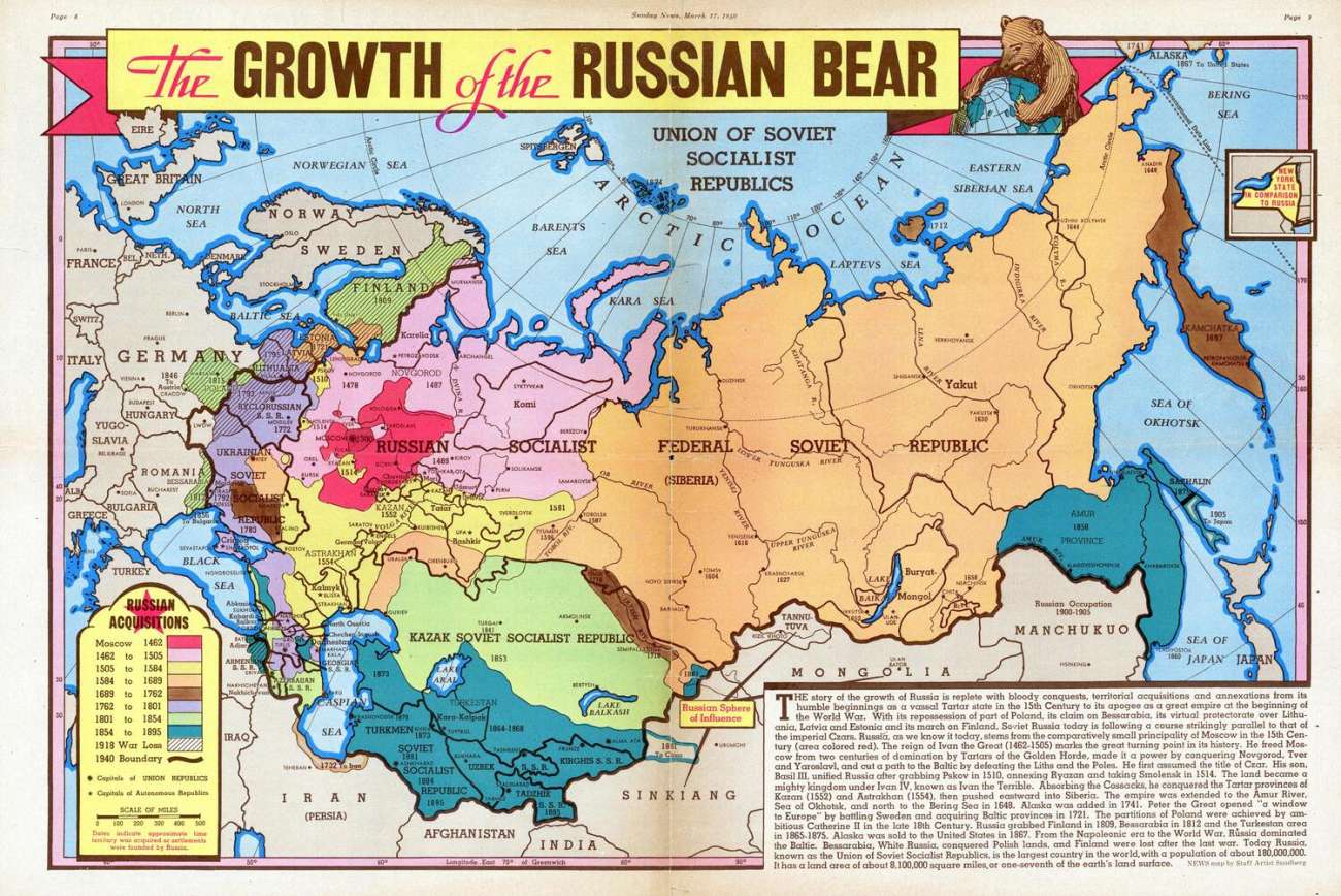
"Growth of the Russian Bear" (Russia / Soviet Union territorial changes, 1940 map)
adawkin:
This map shows the territorial expansion (and, occasionally, territorial losses) of Muscovy / Russia / the Soviet Union (was the map called "Russian Bear" to avoid mentioning all the names?) between 1462 and early 1940.
It was included with a newspaper called Sunday News, which was the Sunday edition of a (still existing) newspaper otherwise called Daily News. For most of its history, the paper operated from New York, which is why the size of the Soviet Union is compared to the size of the State of New York. It was printed with the date March 17, 1940 - at the same time when USSR and Finland were discussing the Moscow Peace Treaty to end the Winter War. So literally just a couple days after the map was done, the USSR had another territorial expansion, gaining Karelia and other smaller territories from Finland. Of course, by the end of 1940, the Soviets would also fully annex the three Baltic states and gain Bessarabia from Romania.
One interesting thing are some now-obsolete English names which ended up losing to other spellings: so there's Tadzhik, Kirghis and Kazak instead of Tajik, Kirghiz/Kyrgyz and Kazakh. Laptev Sea is called Laptevs Sea (this plural form actually makes sense - it was named after two explorers, who were also cousins). Finally, Byclorussian has to be just a misspelling. It was supposed to be Byelorussian.
Collection: territorial-changes - Tags: russia, territorial-changes - Source: reddit.com