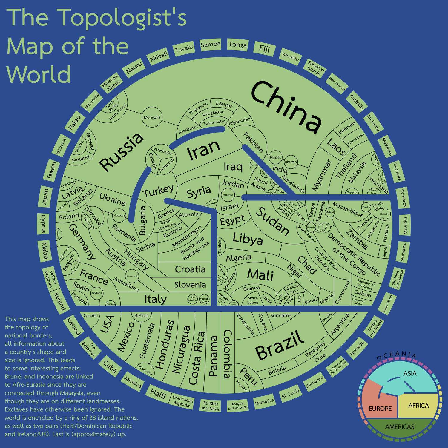
The topologist's map of the world - a map showing international borders, and nothing else
xilefakamot:
Inspired by this map of the USA (by Sian Zelbo), I decided to make a world map in a similar style. Countries are shaped and positioned according only to which countries (and seas) they border.
If you'd like a challenge, here's a version without country labels, and if you'd like a slightly smaller challenge, here's one with only a few labels.
I made this in Inkscape, and put a brief write-up here, if you're interested. Please let me know if you find any errors/typos.
A few caveats: I had to ignore a few exclaves and territories to make this map at all feasible. Most notably, Russia's Kaliningrad Oblast, the Spanish exclaves in Morocco, the Angolan exclave that borders the Republic of the Congo, the British Mediterranean exclaves (Gibraltar and the two on Cyprus), and - the biggest and baddest - French Guyana.
Edit: Here's an updated version with the Bolivia/Paraguay/Argentina/Chile area fixed - thanks, /u/agcuevas
And another, having fixed the South Sudan/Ethiopia/Kenya/Uganda border - thanks, /u/qpalks
/u/Zaragoza23 pointed out that Bahrain is missing, but that'll take a while to fix
Finally, here's a list of /r/MapPorn's favourite exclaves, sorted by number of comments saying I missed them:
Exclave Number of comments French Guyana 83 Kaliningrad 63 Saint Martin 30 Ceuta and Melilla (Spain) 20 Dubrovnik (Croatia) 15 Nakhchivan (Azerbaijan) 14 Gibraltar 13
Collection: topological-maps - Tags: topological-maps - Source: reddit.com